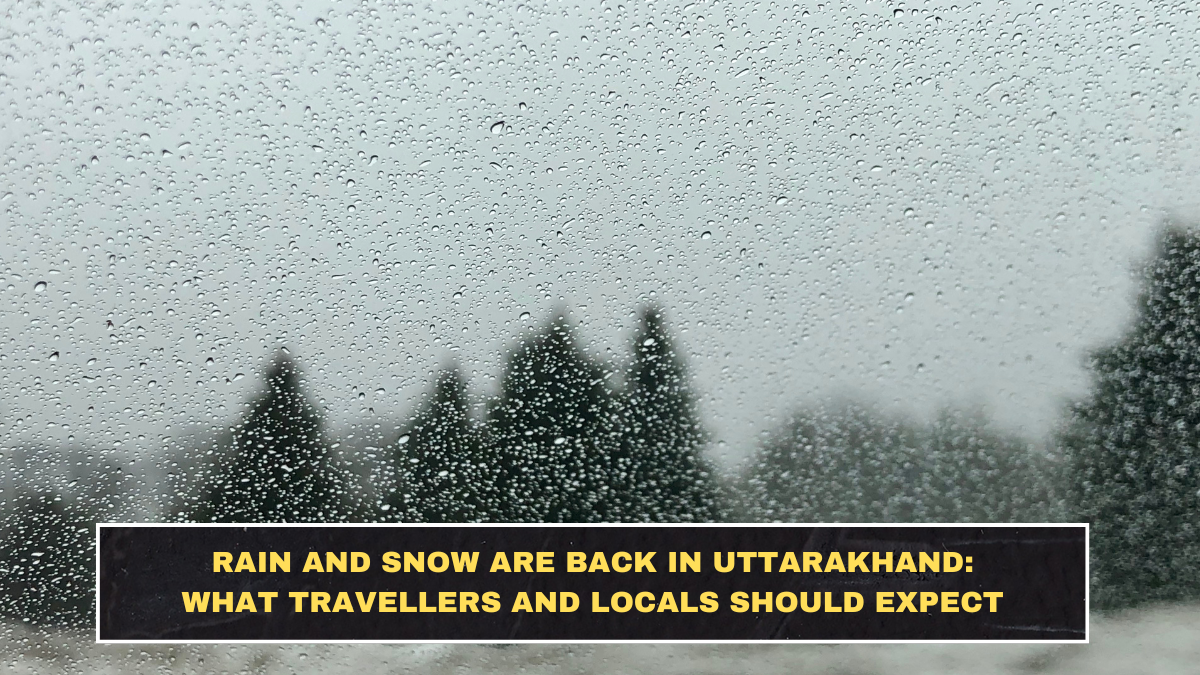
Uttarakhand is back under an active rain-and-snow spell, and this is not just a “pleasant mountain weather” update. The IMD’s Uttarakhand state forecast for March 30, 2026 warns of thunderstorms with lightning, hail, and gusty winds of 40–50 kmph at isolated places, followed by thunderstorms and gusty winds again on March 31. At the all-India level, IMD also flagged hailstorm activity over Uttarakhand on March 30 as part of the current western-disturbance-driven weather system.
Local reporting from Dehradun says intermittent rain has already returned in the plains, while higher-altitude districts such as Uttarkashi, Rudraprayag, Chamoli and Tehri Garhwal are seeing snowfall again. The same report says areas above about 3,300 metres are most likely to receive snowfall, while lower hills and plains, including Dehradun, are more likely to see light rain.
What the Current Warning Actually Means
This weather spell is being driven by active western disturbances over northwest India. IMD’s March 29 national bulletin says Uttarakhand is among the states likely to see light to moderate rain or snowfall around March 30, with thunderstorms, lightning and gusty winds also in the broader warning pattern. The useful point for readers is simple: this is not uniform all-day bad weather everywhere, but an unstable setup where conditions can change quickly across altitude bands.
The Simple Breakdown Readers Need
| Issue | Latest warning/detail | Why it matters |
|---|---|---|
| Rain in plains | Light rain likely in lower hills and plains including Dehradun | City travel and local commuting may be disrupted in short spells. |
| Snow in higher reaches | Snowfall likely above roughly 3,300 metres | Tourist plans and hill-road conditions can worsen quickly at altitude. |
| Wind risk | Gusty winds of 40–50 kmph likely at isolated places | Matters for road safety, exposed travel and outdoor activity. |
| Hail risk | IMD flagged isolated hailstorm activity on March 30 | Important for crops, vehicles and exposed movement. |
| Alert level | Orange alert reported for some higher-altitude districts on Monday | Signals higher disruption risk, not routine drizzle. |
Which Districts Need More Attention
The most weather-sensitive districts in the current spell are the higher-altitude ones. Times of India reported that Uttarkashi, Chamoli, Rudraprayag, Bageshwar and Pithoragarh were under an orange alert for Monday for isolated hailstorms and strong winds, while snowfall and rain were also affecting districts including Tehri Garhwal. That matters because these are exactly the places where tourists, pilgrims and local road users can get trapped into treating hill weather too casually.
What This Means for Travel
For travellers, the biggest mistake is assuming “rain in Dehradun” tells you what the hills will be like. It does not. A plain-rain day can still mean snowfall, slush, reduced visibility and slower road movement in higher zones. The current IMD pattern points to a split: lower areas getting rain and upper areas getting snow, with gusty winds and thunderstorm risk layered on top. That combination is exactly what creates messy hill travel conditions rather than simple scenic weather.
The timing also matters. IMD’s district and state warnings are operational daily forecast windows, not vague weekly guesses. So travellers heading toward higher routes should not rely on yesterday’s weather or a hotel’s casual reassurance. They should check the same-day district warning before departure. That sounds obvious, but most people still do the opposite and then act surprised when the hills behave like hills.
What Locals and Tourists Should Do
Use a practical filter:
- check district-level weather before leaving, not just “Uttarakhand weather”
- treat 40–50 kmph gust warnings seriously in exposed hill stretches
- do not treat orange-alert hail warnings like routine rain
- expect colder conditions and slower movement above snow-prone elevations
Conclusion
Rain and snowfall are back in Uttarakhand, but the real issue is not the return of mountain weather. It is the mix of rain in lower areas, snowfall in higher reaches, hail risk on March 30, and gusty winds strong enough to disrupt hill movement. The districts that matter most right now are the higher-altitude belts, not just Dehradun. For readers, the takeaway is basic but important: check the district warning, respect the altitude difference, and stop pretending hill travel is predictable during an active western-disturbance spell.
FAQs
Is Uttarakhand under a rain and snowfall alert right now?
Yes. IMD’s latest forecasts show rain and thunderstorm activity for the state, while local reporting says snowfall has returned to higher-altitude districts.
Which districts are seeing the most weather impact?
Higher-altitude districts including Uttarkashi, Chamoli, Rudraprayag, Bageshwar and Pithoragarh are among the key districts flagged in current alerts.
How strong are the winds in the current Uttarakhand warning?
IMD’s Uttarakhand state forecast warns of gusty winds up to 40–50 kmph at isolated places.
Why should travellers be careful now?
Because lower areas may only see rain while higher routes can face snowfall, hail, gusty winds and sharply worse road conditions in the same weather spell.